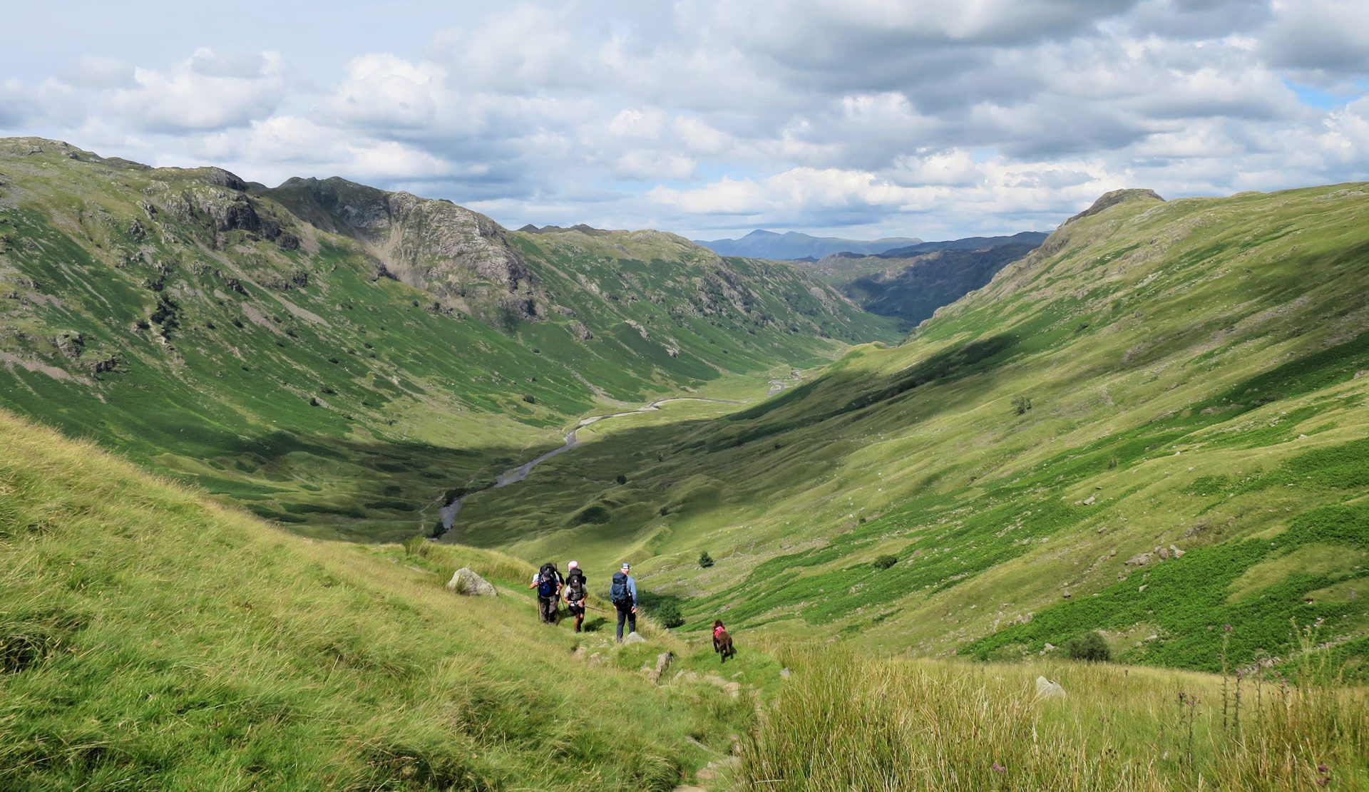
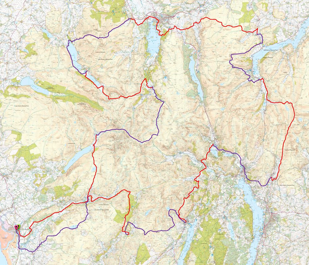
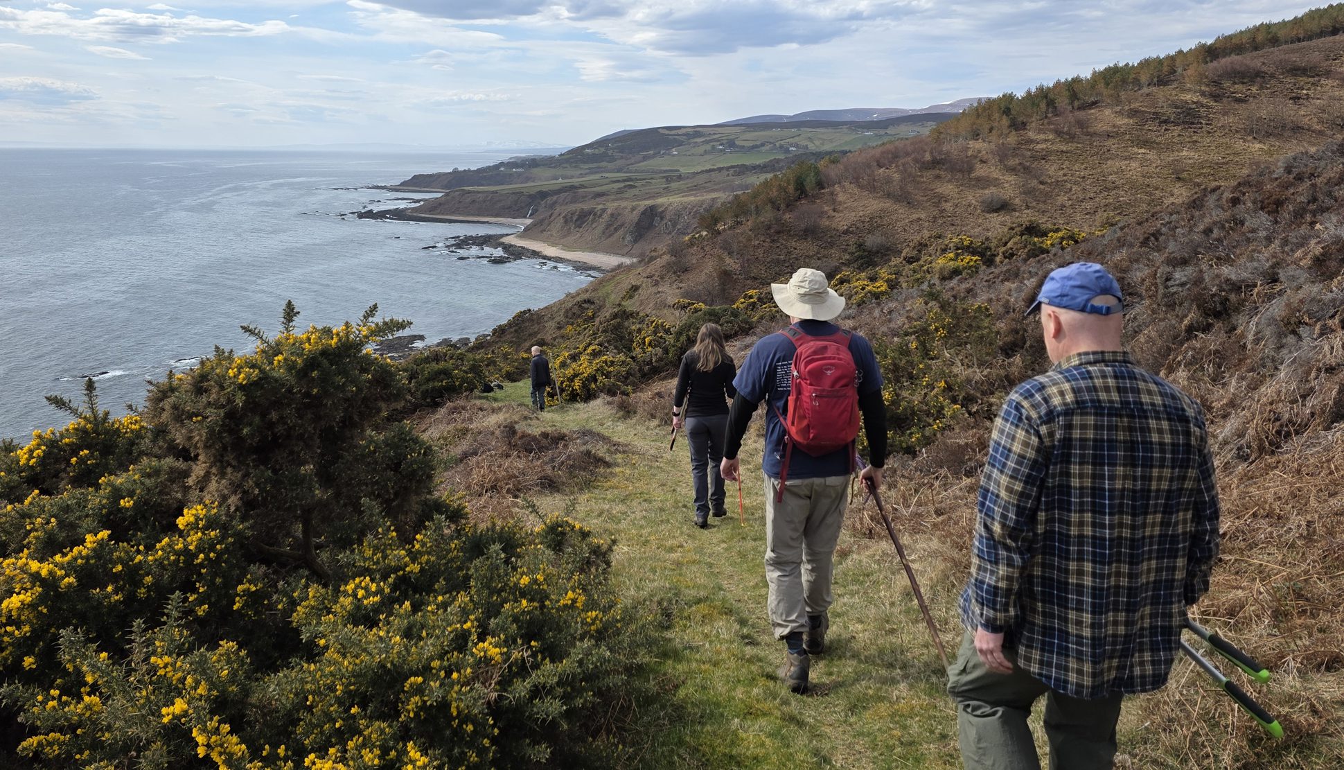
The Lakeland Way is a 144-mile circular long-distance walking route through the heart of the Lake District, the route takes around twelve days to complete and offers an unforgettable journey through some of the finest scenery, landscapes, and history that Lakeland has to offer.
Rather than being a challenge focused on climbing the highest summits, The Lakeland Way is a journey through the wider landscape of the Lake District. The route celebrates the scenery, nature, heritage, and people that have shaped this remarkable part of England.
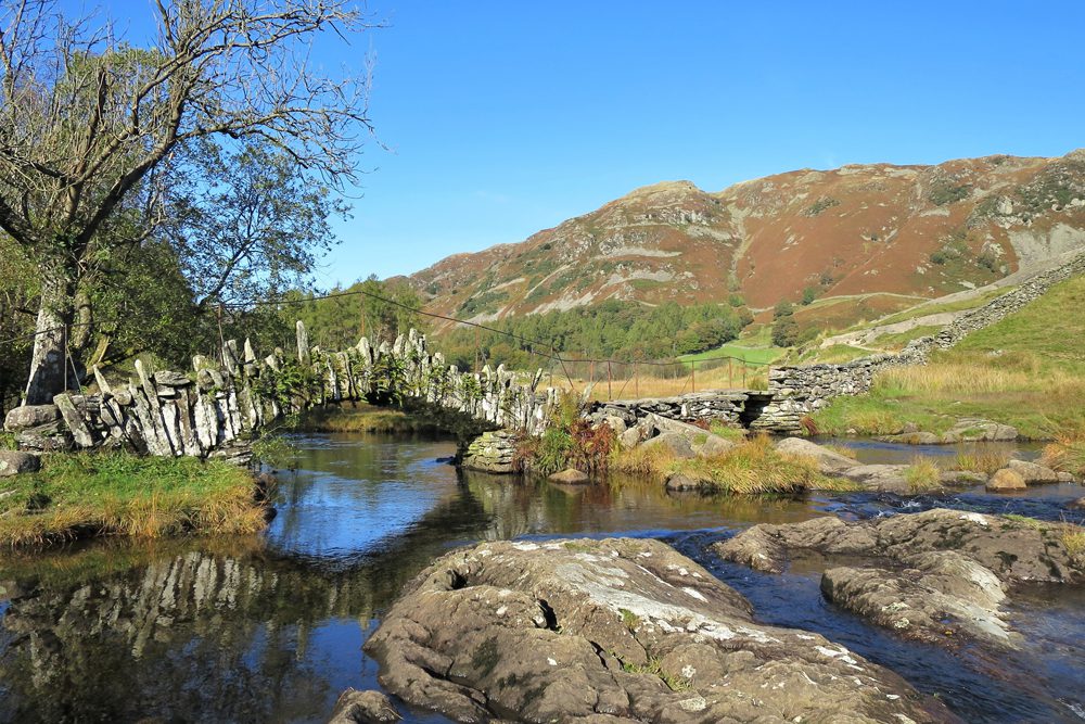
The walk follows a fascinating network of historic paths and ancient routes, including old coach roads, drove roads, corpse routes, and tracks once used by traders travelling between valleys with packhorses. Many of these paths were also used by miners and quarrymen travelling from neighbouring villages and hamlets to their workplaces deep in the fells.
In places, the route follows in the footsteps of Roman soldiers who once marched through Lakeland’s valleys and over its high fells between strategically positioned forts. Along the way, walkers pass close to numerous historical sites, ancient settlements, mines, quarries, bridges, churches, and other reminders of the people who have lived and worked in this landscape for centuries.
From the coast at Ravenglass, The Lakeland Way leads into the mountains, valleys, forests, and remote corners of the Lake District, offering a constantly changing experience of the landscape. Each day brings something different, from peaceful valley paths and historic tracks to open fell country and spectacular views.
The Lakeland Way is not an official National Trail or a waymarked path. It is Richard Jennings’ creation, created to celebrate the extraordinary character of Lakeland and to honour the generations of people who have lived, worked, travelled, and shaped this unique landscape.
Whether you are an experienced long-distance walker or simply have a deep appreciation for the Lake District, The Lakeland Way offers the opportunity to experience Lakeland from a different perspective—following the historic routes that connect its valleys, communities, and fells.
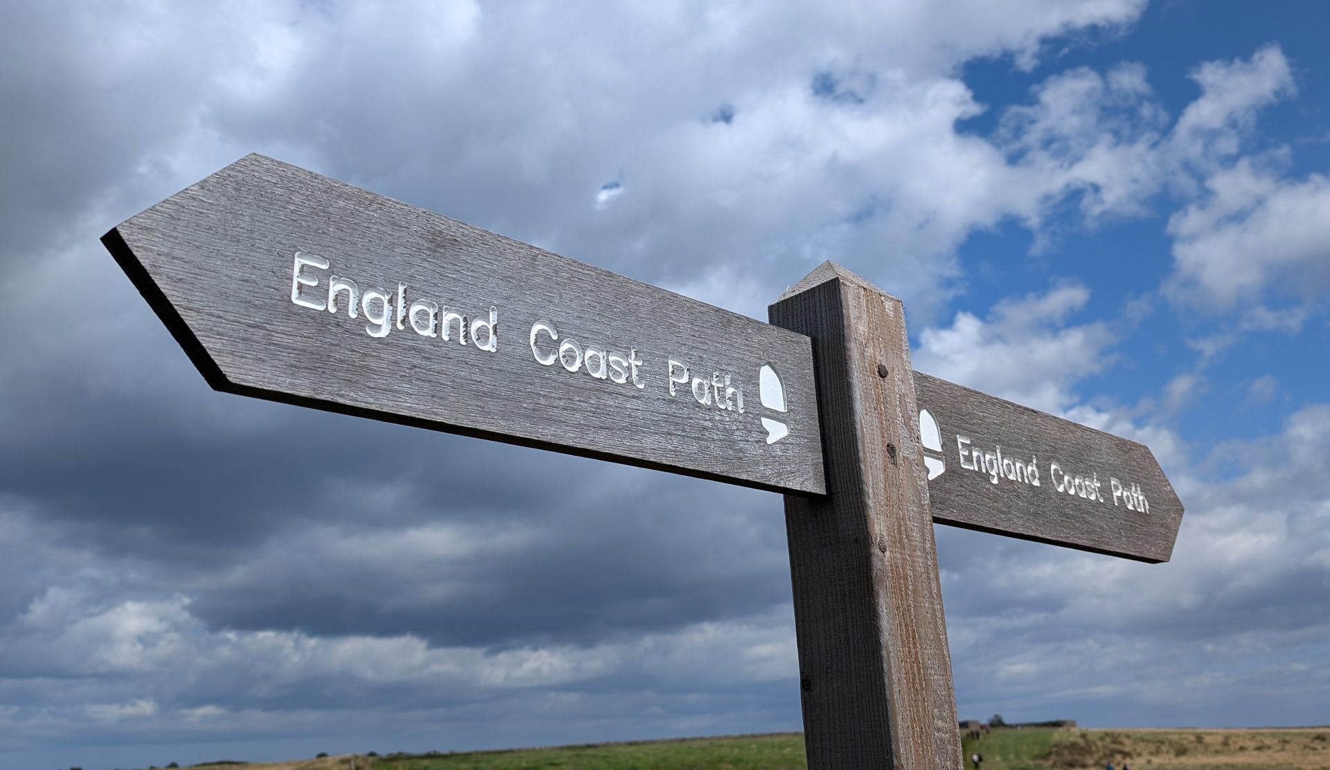
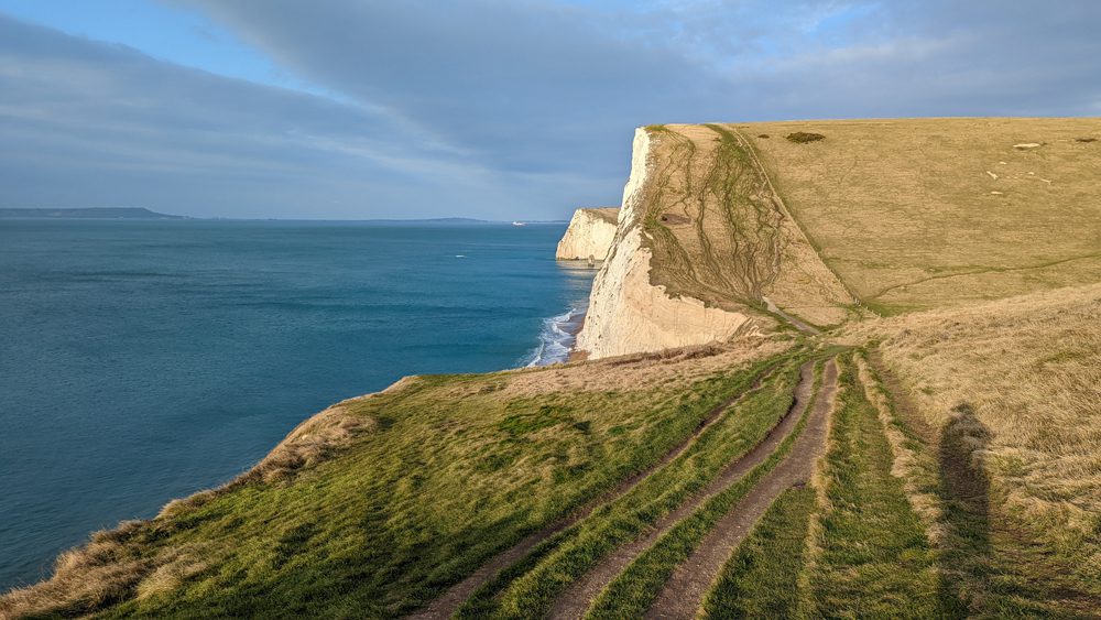
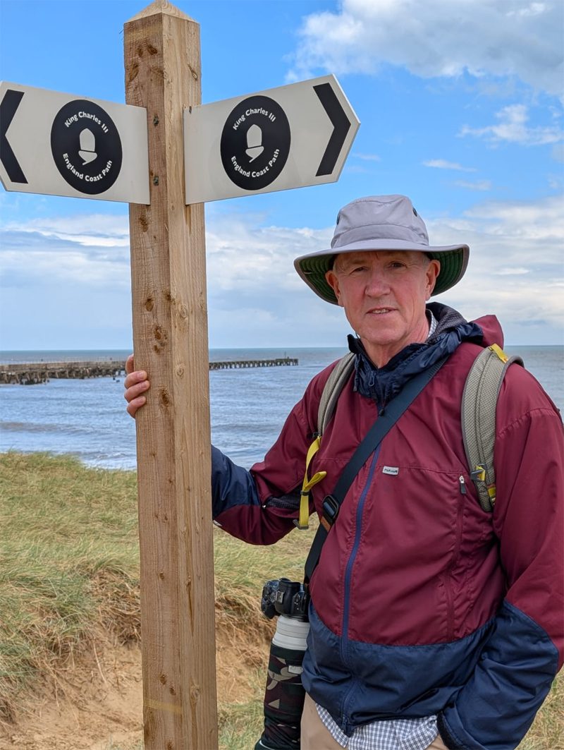
The King Charles III England Coast Path—formerly known as the England Coast Path—is a monumental long-distance walking route that traces the entire coastline of England. As one of the most ambitious coastal access projects in the world, it connects cliffs, beaches, estuaries, and historic seaside towns into a continuous national trail, offering walkers an unparalleled way to experience the diversity of England’s coastal landscapes.
This page focuses on accommodation along the trail, helping you plan where to stay as you explore different sections of the route. Whether you’re tackling a short weekend stretch or planning a longer expedition, the path is supported by a wide range of places to rest and recharge, from comfy hostels with private rooms to bunkhouses ideal for groups. Because the trail passes through both remote natural areas and well-connected towns, accommodation options vary significantly from one section to the next.
Renamed in honour of King Charles III, the trail reflects both its national significance and its evolving identity as a unified coastal path network. While many walking guides and maps still reference the original name, “England Coast Path,” both names refer to the same expanding route managed in stages by Natural England. This guide will help you navigate where to stay along the way, no matter which section of the coast you choose to explore.
The King Charles III England Coast Path links seamlessly with the Wales Coast Path at the England–Wales border, creating the opportunity for one of the longest continuous coastal walking experiences in Europe. You can find hostel and bunkhouse accommodation along the Wales Coast Path here. Together, the two routes allow walkers to trace a remarkable stretch of shoreline that moves from England’s varied coasts into the dramatic cliffs and beaches of Wales.
Why hostels and bunkhouses are ideal for the coast path
Affordable for long adventure
Located close to trail sections and coastal towns
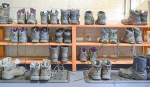
Designed for walkers (drying rooms, boot storage, kitchens)
Social atmosphere for solo travellers
Where to find hostels along the England Coast Path
The maps shows the location of the hostels and bunkhouses, these are available in the geographic sections :
South West England (Cornwall & Devon)
Dorset & Jurassic Coast
South East & Kent coast
East Coast (Norfolk & Suffolk)
North East & North West England
What to expect from bunkhouses and hostels
Private bedrooms are now standard, though budget dorm-style options may occasionally be available.
Self-catering kitchens
Drying rooms for wet gear
Shared lounges and social spaces.
Tips for booking accommodation on the coast path
Tips for booking accommodation on the coast path
Book ahead.
Plan your trip for the off-season. Accommodation on long distance routes is particularly in high demand during the autumn and spring shoulder months.
Mix hostels and Bunkhouses with inns for variety.
Try to avoid carrying camping gear if possible to save your feet and shoulders, and give more sence of freedom
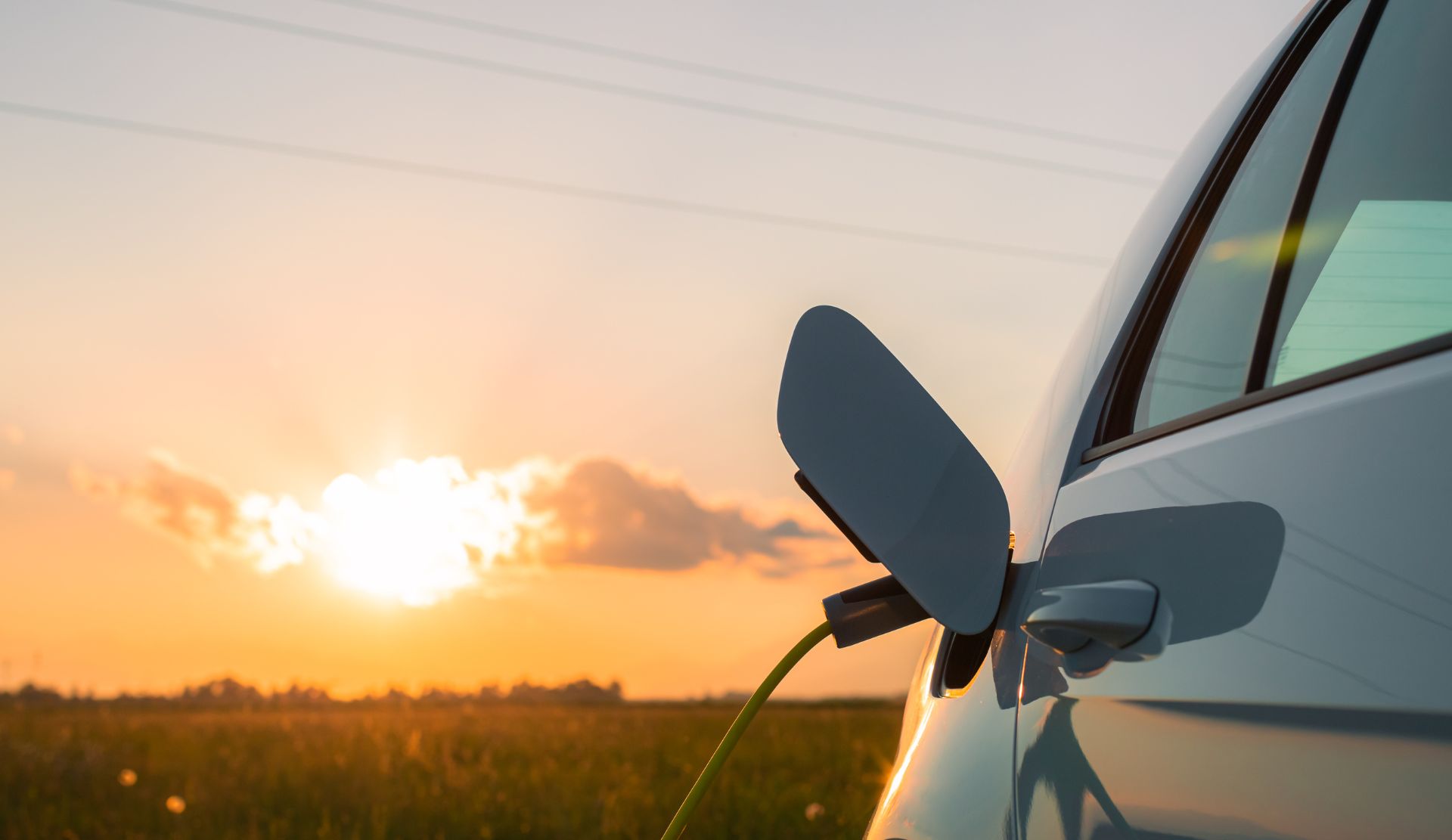
Electric Vehicle Charging and E-Bike Charging at Hostels and Bunkhouses
More travellers are choosing to explore the countryside and towns using electric vehicles (EVs) and electric bikes (e-bikes). Hostels and bunkhouses are often run by environmentally conscious owners who understand the importance of sustainable travel. Many of these properties are now making it easier for guests to travel green by offering electric vehicle charging and e-bike charging facilities on site.
If you are planning a trip with an electric car, electric van, or e-bike, having access to reliable charging can make a big difference to your journey. The hostels and bunkhouses listed on this page provide EV charging points or electric bike charging facilities, allowing you to recharge your vehicle safely while you rest, eat, or explore the surrounding area.
Staying at accommodation with EV charging means you can wake up with a fully charged vehicle ready for the next stage of your trip. For cyclists travelling with electric bikes, access to secure e-bike battery charging is equally important, especially after a long day of riding through hills, countryside trails, or coastal routes.
Each property featured here offers different facilities. Some provide dedicated electric vehicle charging points, while others may offer standard power outlets suitable for e-bike battery charging. Many hosts are happy to help guests find the best way to charge their vehicles and ensure everything is done safely.
Below you will find detailed descriptions of each hostel and bunkhouse, including information about their EV charging availability, e-bike charging options, and other useful amenities for travellers arriving with electric transport.
Whether you are planning a cycling holiday with an e-bike or a road trip in an electric vehicle, these eco-friendly places to stay make it easier to travel sustainably and enjoy your journey with peace of mind.
The South West Coastal 300 (SWC300) is the perfect Scottish road trip for those who love adventure, scenery, and discovery. Far more than just a driving route, it offers breathtaking coastal views, spectacular landscapes, and a wealth of attractions and experiences along the way.
This 300-mile circular route traces the stunning south-west coast of Dumfries & Galloway and South Ayrshire, showcasing sandy beaches, rugged clifftops, rolling hills, and charming towns and villages. Every turn reveals something new, making this an unforgettable journey with something for everyone.
Highlights include Scotland’s most southerly point, the dramatic Mull of Galloway, and Wanlockhead, the country’s highest village (and no, it’s not in the Highlands!). The route also passes through the magnificent Galloway Forest Park, famous for its tranquil woodland trails, dark skies, and abundant wildlife.
Whether you’re drawn by scenery, history, or outdoor adventure, the South West Coastal 300 is the ultimate way to experience Scotland at its most varied and beautiful.
There is a route available for cyclists and EV charging points for electic vehicles — making the SWC300 the perfect low-emission road trip through Scotland’s stunning south-west.
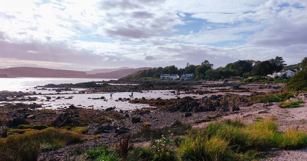
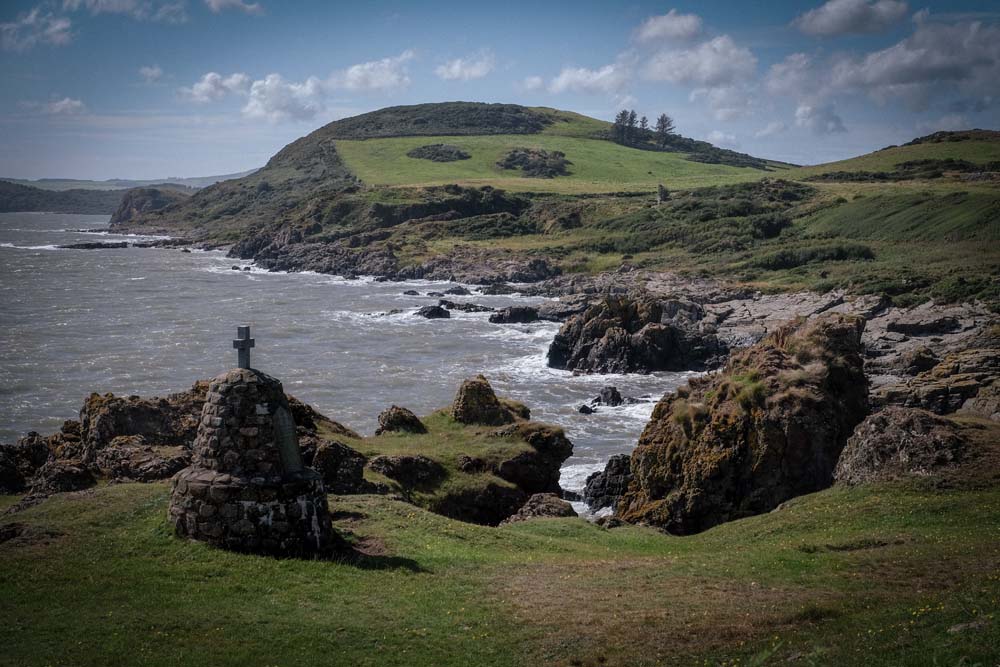
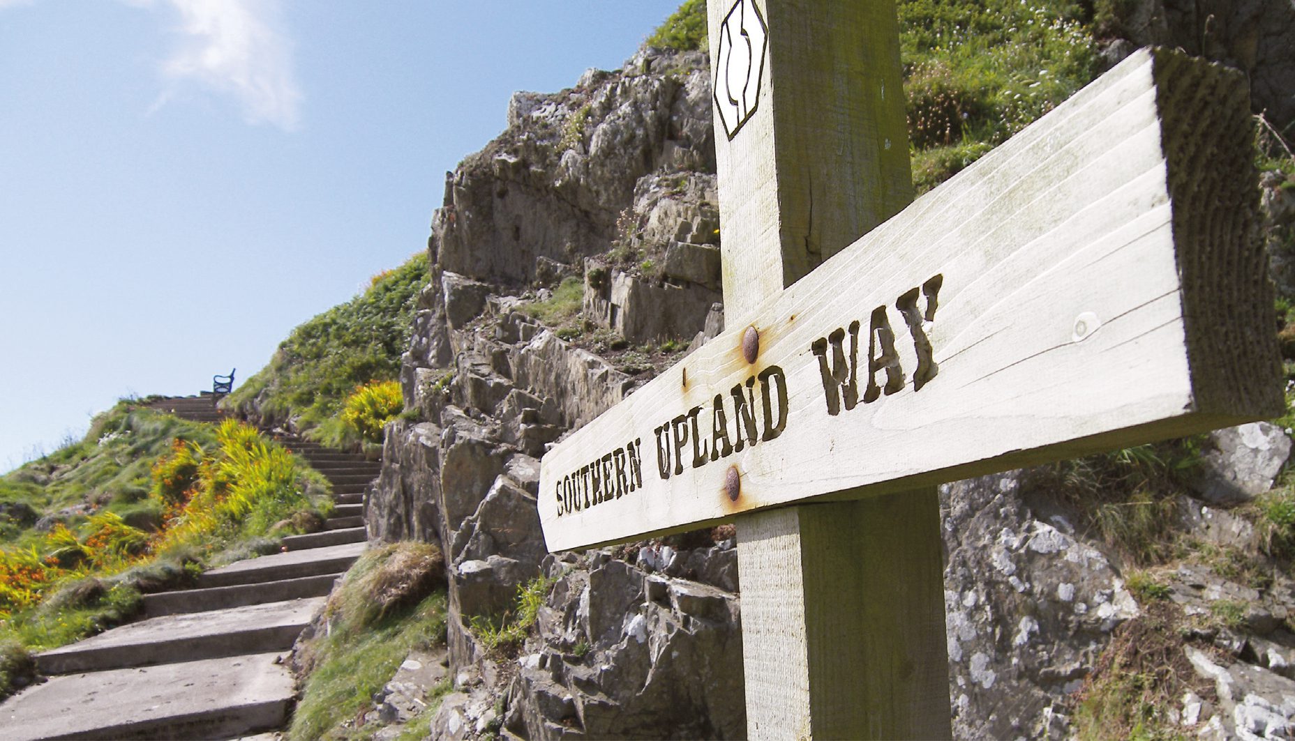
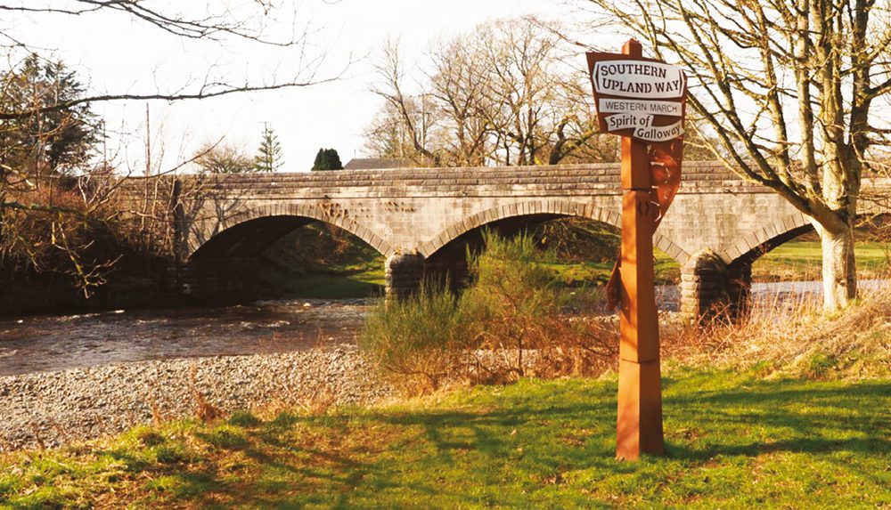
The Southern Upland Way is Scotland’s first official coast-to-coast long-distance trail, and one of the country’s great walking adventures. Stretching for about 341 kilometres (212 miles), it crosses the breadth of southern Scotland from Portpatrick on the rugged Atlantic coast to Cove, near Cockburnspath, on the North Sea.
Following old drove roads, moorland tracks, forest paths, and quiet farm lanes, the route weaves through some of the most remote and beautiful landscapes in the Scottish Borders and Dumfries & Galloway. Walkers pass through rolling hills, tranquil valleys, and historic towns such as Moffat, Sanquhar, and Melrose, with hostels and bunkhouses along the way.
Hostels and bunkhouses are a great resource for walkers along the Southern Upland Way. They often have drying rooms for wet gear and self-catering kitchens for those travelling on a budget. For walkers looking to treat themselves after a long day on the trail, there’s often a home-cooked meal or welcoming pub nearby.
Best of all is the social atmosphere — perfect for swapping route tips, sharing stories, or even teaming up for a stage of the walk. This friendly sense of community is one of the true highlights of long-distance walking.
Although less famous than the West Highland Way, the Southern Upland Way offers a wilder, more solitary experience — a journey of open horizons, big skies, and long, quiet miles. Along the way, walkers encounter remnants of Scotland’s history, from Iron Age hillforts and Roman roads to ruined abbeys and remote shepherd’s cottages.
The route can be walked in sections or tackled in its entirety, typically over 12–16 days. It’s suitable for experienced long-distance walkers who are comfortable with navigation and variable weather conditions, as some stretches are isolated and exposed.
Whether taken as a personal challenge or a chance to explore one of Scotland’s least-visited regions, the Southern Upland Way rewards perseverance with a profound sense of space, solitude, and achievement — a true crossing of Scotland from sea to shining sea.
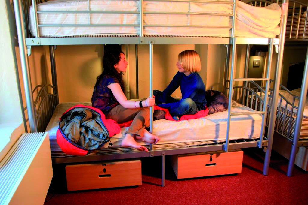
Many hostels and bunkhouses have private rooms with en suite facilities.
Hostel en suite rooms have all variations of beds. Some have a double bed or twins, there will be family rooms with a mixture of bed and bunks and others with a number of bunks, ideal for large families or groups.
You can book a private en suite bedroom and have the benefit of a self catering kitchen and other shared areas around the hostel. Enjoy the social atmosphere of the kitchen, lounge and garden and retire to your en suite room for a refreshing night’s sleep.
Sadly, too many lives are tragically lost to the dangers of cold water swimming every year. At Independent Hostels we are all about promoting the benefits of wild swimming, but please take care to know the dangers before you dip! Read our top tips to keep you safe in the water this Summer…
Know your water. Check weather, tide times and water conditions before you go.
Never swim alone. Tell someone where you’re going and when you’ll be back.
Enter cold water slowly to avoid cold water shock, and take time to control your breathing. Long deep breaths!
Know how to get out before you get in! Always plan your exit point as steep banks can be slippery.
If in trouble, float on your back, try to stay calm and control your breathing – panicking will only make things worse.
Get out immediately if you feel confused, numb, or uncontrollably cold.
All the hostels on this page are perfect for UK family holidays, as they all have private family rooms. These are ace because family rooms come in all sorts and sizes. It does not matter how large your family is. Hostel family rooms sleep between 2 and 20 and so families of 6 or 8 are easily accommodated.
A private room ideal for family holidays
A family room in a hostel will often have a double bed and bunks too. They come with or without en suite facilities. The best thing about family rooms in hostels is that you still have the opportunity to socialise with people in the rest of the hostel. Playmates for the children and an opportunity for you to strike up a conversation while making a cup of tea in the kitchen or over a board game in the common room.
Social areas in a bunkhouse with private rooms
Bunkhouses and hostels provide great social areas and gardens, great for soaking up the evening sun or letting off steam with the kids.
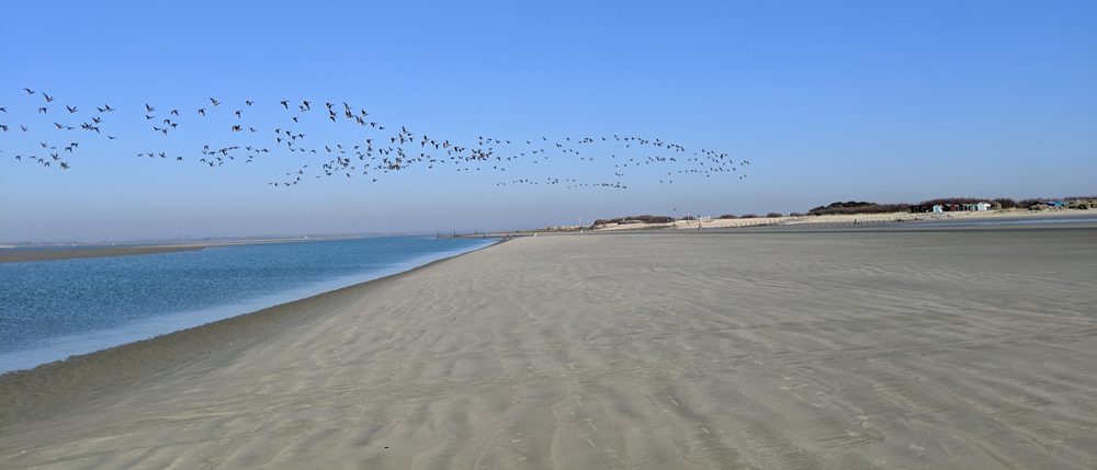
A holiday by the sea is perfect for all ages. Children love nothing more than playing in the sand on one of the UK’s thousands of beautiful beaches or stepping into the sea for the very first time. The anticipation of seeing the water for the first time after a long car journey and it making their faces light up is almost worth making the trip on its own. The country’s stunning coastline provides walkers with miles of paths to explore and enjoy. Finding a “hidden cove” where most won’t venture and spending an evening in a peaceful place with just you, the sand, and the waves is an incredibly tranquil experience guaranteed to relax even the most stressful of souls. Hostels by the sea provide an affordable way to stay in some of the UK’s best locations.
Hostels and bunkhouses by the sea provide great accommodation for inexpensive family seaside holidays
Why stay in a hostel by the sea?
Each bunkhouse and hostel by the sea is unique. They come in all shapes and sizes, from just 4 or 6 beds to over 100. Some are in modern purpose-built buildings, whereas others have been converted from former schools, barns, fisherman’s cottages, or country houses. Some hostels and bunkhouses by the seas offer extra accommodation in yurts or bell tents. Others allow camping on their grounds. Why not take time to explore the map?
Have a look at the map of the coast of Britain and see for yourself all the wonderful places you can stay. Remember lots of hostel and bunkhouse accommodation can be booked for as short a period as one night. So it is perfect for stop-overs to break your journey or for a touring holiday. But many guests prefer to stay for longer, to make the most of the idyllic locations so many of these hostels and bunkhouses are in.
Hostel and bunkhouse accommodation often includes small private rooms, which are perfect for families or couples. While large family gatherings and groups of friends often book the whole hostel out on a sole use basis. So they can enjoy having the whole building and all its facilities to themselves.
What to do
Staying in a hostel by the sea allows you to take part in some amazing activities that only the coastal areas of the country can offer. Water sports are prevalent in coastal towns. Sailing on the open ocean is an unmissable experience. Surfing in Cornwall is exhilarating but if you’re looking for a more relaxing day then why not go fishing? You might even catch your dinner.
Wildlife lovers are spoiled for choice, you could go looking for rare sea birds that make their home on the cliffs and shorelines or out to sea on a guided tour and the astounding local knowledge will guide you to see seals and other creatures that call the British coastline their home. Although the most reliable way to get up close and personal with British wildlife is to buy some local, delicious fish and chips and then wait for the inevitable seagull raid to take place.
You can see amazing wildlife when you stay in a hostel by the sea
Please remember that our hostel and bunkhouse accommodation on the coast does get booked up quickly, especially in the school holidays. So don’t be disappointed, start your search now and book your hostel or bunkhouse before it’s too late.
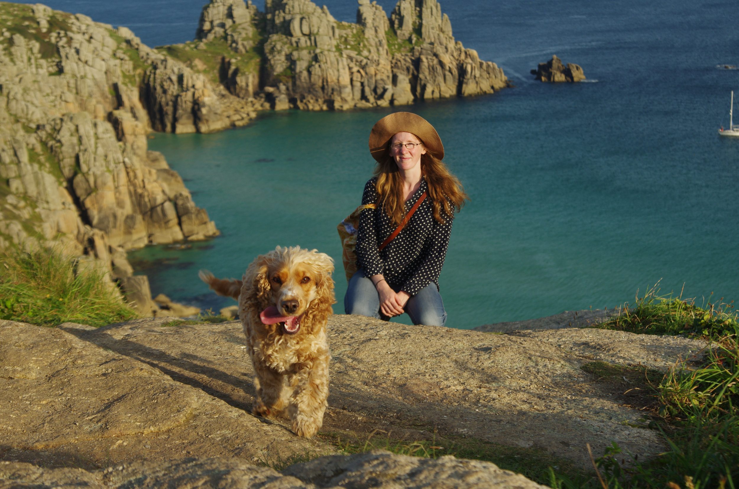
Dog friendly accommodation in hostels and bunkhouses:
All our dog friendly accommodation is shown on the map. There are so many hostels and bunkhouses in the Independent Hostels network that would love to welcome you and your dog. We have dog friendly accommodation throughout the UK, from Sussex to the Scottish Highlands. You will even find places to stay with your dog on some of the Scottish Islands. These dog friendly hostels and bunkhouses are often ideal locations for holidays with your dog. There is a wide choice of hostels and bunkhouses in awe-inspiring locations in the National Parks of Britain. Many are dotted along the UK’s stunning coastlines, ideal for coastal walks and most are in rural locations. From your dog friendly accommodation, you can explore seaside towns, wild moorlands, historic battlefields, and ancient hills. You can walk through woodlands, along picturesque rivers, through hidden villages, and across our green and pleasant land.
Why bring your dog on holiday with you
Taking your dog with you on holiday is a real treat for you and your dog. Seeing their happy face and wagging tail as they arrive in a new place is a true joy and will warm even the coldest of hearts. Their senses will overwhelm them with excitement and in their own unique and special way they will thank you for bringing them along on an amazing adventure.
Bunkhouses and hostels provide great value self catering accommodation. They are well suited to groups of friends or families and because they provide accommodation for as short a period as one night. They are ideal for a stop-over to break a long journey. But why stay for just one night? You, your friends and family, and your dog will be welcome for as long as you like. All of our many hostels that allow dogs are displayed on the map above. On the individual hostel, pages look out for the brown dog friendly symbol shown below. This same symbol is used in the printed Independent Hostel Guide. You can send an inquiry to a number of dog friendly hostels using our Send Enquiry service. Look for the ‘Dogs by arrangement’ tick box.
Two dogs enjoying a day out together
What to look out for
Once you have established that the hostel or bunkhouse you wish to stay in welcomes dogs be sure to pre-arrange your visit with the hostel manager. Some hostels and bunkhouses have a limited number of dog friendly rooms and the managers will need to check availability. Other bunkhouses have a policy of only one dog staying at a time in an effort to prevent doggy conflicts. Some of the hostels are on farms where livestock and farm dogs are around. Always keep your canine friends on a lead unless you have been informed otherwise.
A beautiful walk from Knoydart Dog Friendly Bunkhouse, Inverness-shire
Here are some examples of Dog Friendly Accommodation from the Independent Hostel Network
Here are some stories from just a few of the hostels and bunkhouses providing dog friendly accommodation in our network. Deepdale Rooms and Camping in North Norfolk has dog friendly rooms in the hostel as well as a dog friendly Tipi and their website also has a guide to the area which tells you about dog friendly pubs, cafés, and beaches as well as ideas for walks.
Walking along the beach in front of Bamburgh Castle
Pentre Bach Bunkhouse in Snowdonia is an eight-minute walk from a local pub that welcomes dogs in the bar additionally there is a sheepdog trainer next door and you can often see him training his collies. The accommodation is dog friendly and the 250-yard track to the barn has grassy areas all the way down. Making it ideal for constitutional walks.
Gilfach Wen Barn welcomes dogs and is adjacent to the Brechfa Forest and not far from the Brecon Beacons. The forest is designated as a dog friendly tourism destination by Carmarthenshire County Council because of the wide range of tracks and trails on which walkers have the right to roam through the forest. What could be better for your lovely long dog walks?
New Ing Lodge is on the Coast to Coast path and most of their canine visitors have walked a long way before reaching them (probably at least twice as far as their owners!). That’s why there is a dog bed available so they too can have a comfortable rest for their tired paws additionally they have large grounds at the back of the building for the dogs to stretch their legs as well as a walled garden in front of the house so you can let your dogs run off lead.
So what are you waiting for?
As you can see there is really no reason at all why you should leave your dog at home or in kennels when holidaying in Independent Hostels. Independent hostels offer great value accommodation and provide even better value when you don’t have the extra cost of kennelling on top of your other expenses making the only difficult decision to make is where to go. But with so many options to choose from because there is certain to be the right holiday destination for you and your dog. So wherever you fancy going, you’ll find an independent hostel perfect for you and your four-legged friend.
The mountains of England, Scotland and Wales boast a wonderful selection of hostels and bunkhouses. They offer great value self-catering accommodation in stunning mountain locations. These hostels and bunkhouses have grown up over the years to meet the accommodation needs of the hundreds and thousands of visitors to the UK’s spectacular mountain ranges such as the Cairngorms and the Grampians in Scotland, the Cumbrian Mountains and the Pennines in England and Snowdonia (Eryri) and the Brecon Beacons (Bannau Brycheiniog) in Wales.
Skiddaw Mountain in the Lake District
In the United Kingdom and the Republic of Ireland, a mountain is usually defined as any summit at least 2,000 feet (or 610 metres) high, whilst the official UK government’s definition of a mountain, for the purposes of access, is a summit of 600 metres or higher.
Self-catering Accommodation for Mountain Adventurers.
Whatever your passion, be it mountaineering, hill-walking, rock climbing, skiing, snowboarding, ice climbing, scrambling, mountain biking, Munro or Wainwright bagging, golf, canoeing, kayaking or canyoning you are sure to find a hostel or bunkhouse close to your chosen area. Use the map (enlarge it as necessary) as a quick and easy way of finding the closest accommodation to the area you want to visit.
Many of these hostels have been specifically designed with mountain sports enthusiasts in mind. Indeed some are run by mountain guides and offer guidance and lots of advice. Others are outdoor activity centres and you can hire equipment and provide instruction. The facilities will typically include a boot room, drying facilities, equipment storage, robust central heating, plenty of hot water and large comfortable bunks. Along with a warm welcome, great company and lots of local knowledge. Click any of the red flags on the map above and you will get to our feature of that hostel or bunkhouse with all relevant details. Scroll down that page and you can link to the hostel’s own website for even more information.
Hostels and Bunkhouses for Mountain Lovers.
You don’t have to be an adrenaline junkie to feel at home in the mountain hostels and bunkhouses. Almost all the hostels and bunkhouses in the UK’s mountainous regions are accessible by car and provide low cost, self-catering accommodation as you tour the mountain ranges. Uniquely hostels and bunkhouses are the only type of self-catering accommodation that you can book for just one night. Of course, you can book for much longer too! Photographers, wildlife watchers and nature lovers whether they are individuals, families or groups of friends are all frequent visitors to the mountain hostels and bunkhouses in the UK. You will also find that many hostels and bunkhouses in the mountain regions also have private and family rooms.
Hostels and Bunkhouses in the Mountains of Scotland
You will find hostels and bunkhouses in all the main Scottish mountain areas. In the Cairngorms at the eastern edge of the Grampian mountains; around Ben Nevis, the UK’s highest mountain; in Fort William, the spiritual home of downhill mountain biking and near to the Cullin Ridge in Skye, said to make the experienced walker’s heart flutter!
Knoydart Bunkhouse on the remote peninsula of Knoydart is ideal for mountain lovers. Cut off from the Scottish mainland by rugged, mountainous terrain with few paths, Knoydart is home to 3 Munros including mainland Britain’s most westerly, Ladhar Bheinn. A National Scenic Area with miles of stunning walks, both high up and in the glens. Knoydart is also a haven for coastal and land-based wildlife. Bring walking boots and binoculars and you’re set for a holiday to remember.
And if you are a Munro bagger you are sure to find a hostel or bunkhouse close to most of the 282 Munros. A Munro is defined as a Scottish mountain over 3,000 feet (914 metres) in height. They are named after Sir Hugh Munro who was the first person to compile a list of them in 1891.
Hostels and Bunkhouses in the Mountains of Wales
There are also plenty of hostels and bunkhouses in the mountainous areas of Wales. From the map above you will see that these tend to cluster in Snowdonia (Eyri) and the Brecon Beacons (Bannau Brycheiniog). Both areas are a haven for the mountain lovers amongst us. With a huge range of activities and tourist attractions on hand, it’s easy to see why. Climbers, walkers, mountain bikers, canoeists and kayakers are all regular visitors to both the Welsh mountains and the local hostels and bunkhouses.
While Bounce Below, deep inside Llechwedd slate caverns, Zip World Velocity, is the longest zip line in Europe and the fastest in the world. The National Whitewater Centre in Bala, and Snowdon Mountain Railway in Llanberis are just a few examples of the hundreds of tourist attractions in the Welsh mountains to keep you and your family entertained.
Snowdonia (Eryri) mountain landscape
Hostel and Bunkhouses in the Mountains of England
Many of the hostels and bunkhouses in the mountains of England are found in the Lake District. Others are located in and around the Northumberland National Park, the Yorkshire Dales and the Peak District. The map will show you their exact location. Once again these hostels and bunkhouses provide all types of visitors to the mountains of England with cost-effective and flexible accommodation in a stunning mountain setting.
Skiddaw House is one of the most loved mountain hostels. High up on the shoulder of Skiddaw Mountain this old hunting lodge has been preserved by generations of trustees to provide a warm and comfortable welcome in the wilds of the Lakeland Mountains.
Skiddaw Mountain showing Skiddaw House Independent Hostel
Bring your club or group of friends/family to a mountain hostel or bunkhouse.
Many of the hostels and bunkhouses in our beautiful British mountains can be hired exclusively for your group or party. These ‘sole use’ bookings have become more and more popular in recent years, as groups of friends, families and sports clubs enjoy the space and the facilities that these hostels and bunkhouses provide. Not to mention the very good value for money a ‘sole use’ booking represents.
How about spending a big birthday, Easter, Christmas or New Year with a big group of friends or family in a spectacular mountain location? Surrounded by stunning views, loads of wildlife and wonderful dark skies? You need look no further as there is sure to be a hostel or bunkhouse to suit your needs.
The spectacular National Parks in England, Scotland, and Wales boast a wonderful selection of hostels and bunkhouses.
These hostels and bunkhouses offer great value, flexible, self-catering accommodation to the many and varied visitors to the National Parks. Singles, couples, families, groups of friends or families, clubs, etc all enjoy the friendly atmosphere and communal ethos that hostels and bunkhouses offer.
Bunkhouse in the Peak District National Park
If you go to the map you will see all the hostels and bunkhouses in the National Park you want to visit. Click on the red marker and again on the hostel name and you will get all the key information about that hostel or bunkhouse; the number of rooms, the facilities, the price, etc. Scroll further down for contact details and the link to the hostel’s own website.
To help your search you can use the ‘Find by’ tool at the top of any hostel’s page. Search by your preferred ‘location’, the hostel’s ‘facilities’, ‘activities’ in the area, and/or ‘availability’. Don’t forget, hostels and bunkhouses allow guests to stay for as short a period as one night. Of course, you are most welcome to stay for much longer!
What is the difference between a hostel and a bunkhouse?
Each hostel and bunkhouse is unique so it is important to explore our database. Some are very large and can cater to clubs and big family/friend get-together’s. Others are much more cozy with just a few beds. Some have just dormitory-style rooms whereas others also have private or family rooms with either bunk or conventional beds. The difference between a hostel and a bunkhouse is very woolly. Often the name is historic and while the accommodation has evolved over the years, the name has not. You may also come across a number of camping barns in some of the National Parks. These are much more basic and are often little more than a ‘stone tent’. You will most likely need to bring all your own sleeping and cooking equipment. However, they are some of the best value for money forms of accommodation you can find.
Yorkshire Dales National Park
The history of National Parks and the history of hostels and bunkhouses.
There are now 15 National Parks in the UK. The newest, the South Downs, was established in 2010. But the first National Park to be designated was the Peak District in 1951.
The history of the National Parks is fascinating. The impetus to form National Parks started some 20 years earlier with The Mass Trespass on Kinder Scout in 1932. In the years that followed organisations such as the Rambler’s Association, the Youth Hostels’ Association (YHA), the Council for the Preservation for Rural England (CPRE) and the Council for the Protection of Rural Wales (CPRW) rallied together to lobby the government for measures to protect and allow access to the countryside. Which has hugely benefited the nation.
Walkers in Exmoor National Park
But it wasn’t until the 1950’s that 10 National Parks were designated. In addition to the Peak District there were; The Lake District, Snowdonia (Eryri), Dartmoor, Pembrokeshire Coast, North York Moors, Yorkshire Dales, Exmoor, Northumberland, and the Brecon Beacons (Bannau Brycheiniog). There was a long wait until 1989 for the next new National Park, The Broads to be designated. Then in the 21st century Loch Lomand and the Trossachs, Cairngorms, The New Forest, and The South Downs were all established. Who knows where could be next?
The history of hostels and hostelling is closely bound with the history of the National Parks and the desire by many in the population to gain access to the countryside. As a result, some of the earliest hostels and bunkhouses were set up in the first National Parks. As the number of visitors to the National Parks increased more and more hostels and bunkhouses were set up to cater to them. Now there are hundreds of hostels and bunkhouses in our network which are located in the UK’s National Parks.
Hostels and Bunkhouses in the Peak District.
As well as being the first National Park, the Peak District is one of the most popular, with over 10 million visitors each year. Not surprisingly there is a wide selection of hostels, bunkhouses, and camping barns offering visitors great value, self-catering accommodation. Go to the map above to see exactly where these hostels, bunkhouses, and camping barns are located.
You will find them conveniently situated for all the Peak District attractions; the 1,600 miles of public rights of way, the 65 miles of off-road dedicated cycling and walking trails including the disused railways; High Peak Trail, Tissington Trail, and Monsal Trail. There are bunkhouses and camping barns in Edale, the starting point of Pennine Way, Britain’s oldest long-distance national walking trail and the gateway to Kinderscout, which at 636 meters (2086 ft) is the highest point in the Peak District. As well as walkers, cyclists, and mountain bikers, frequent guests at the Peak District hostels and bunkhouses are climbers. This is because the Peak District is the training ground for some world class climbers.
Snowdonia National Park (Eryri).
For the less active there is a wonderful selection of beautiful country houses and stately homes to visit. Such is their charm that they are often used as film sets. You might recognize: Chatsworth (Pride and Prejudice), Haddon Hall (Jane Eyre, Pride and Prejudice, Elizabeth, Henry VIII, Moll Flanders), North Lees Hall (Jane Eyre, Pride and Prejudice, The Other Boleyn Girl). And once again you’ll find a hostel or bunkhouse just a short drive away.
Don’t delay, search our database for the perfect hostel for your next visit to one of the UK’s National Parks.
For many, private rooms are a necessity when it comes to traveling in hostels. While some of the more hardcore backpacker crowd might disagree, it’s becoming more and more accepted that a lot of hostels now offer these rooms. The reasons for having a private room vary however the perks remain the same throughout.
Why are private rooms so popular?
As the word implies private rooms offer a deal more privacy than the standard dorm room, invaluable for the light sleepers who can’t sleep without total silence. Families also benefit from having a little bit more room and their own space as children sometimes need their own space (parents need their own space to relax and unwind as well) and having your own room offers that where a dorm can’t. Couples traveling the country together who want their own space will love the privacy of having their own room offers in a way that a dorm can’t.
Novice travelers who may be hosteling for the first time can find the idea of staying in a dorm full of strangers daunting or off-putting. Having their own room allows those unsure about the hosteling experience to dip their toe in the community atmosphere while being able to retreat to their own space should they want to. The welcoming atmosphere and being surrounded by like-minded, friendly people is what keeps people coming back to hostels year after year, private rooms are a great way to introduce people to that.
All the benefits of a hotel with hostel prices
Having your own room in a hostel offers affordable accommodation similar to a hotel but with all the benefits of a hostel. Many will have adjoining en suites allowing you to be completely separate when you want to be.
The use of the self-catering kitchens and social areas makes the whole experience much more personal. Just because you’re in your own room doesn’t mean you have to stay in it!
The friendly atmosphere of hostels is what keeps people coming back year after year. Meeting new people and hearing their experiences is still as easy to do as in a dorm. Socialize over breakfast or by the fire in the evening. All the while knowing you can retire to your cozy room when you’re ready for bed.
Treat yourself to a bit of luxury
While bunk beds are tried and tested it’s always nice to treat yourself every now and then. With many of the rooms offering double beds, they’re perfect for getting a good night’s sleep. Just what you’ll need after a day out exploring some of the UK’s best locations.
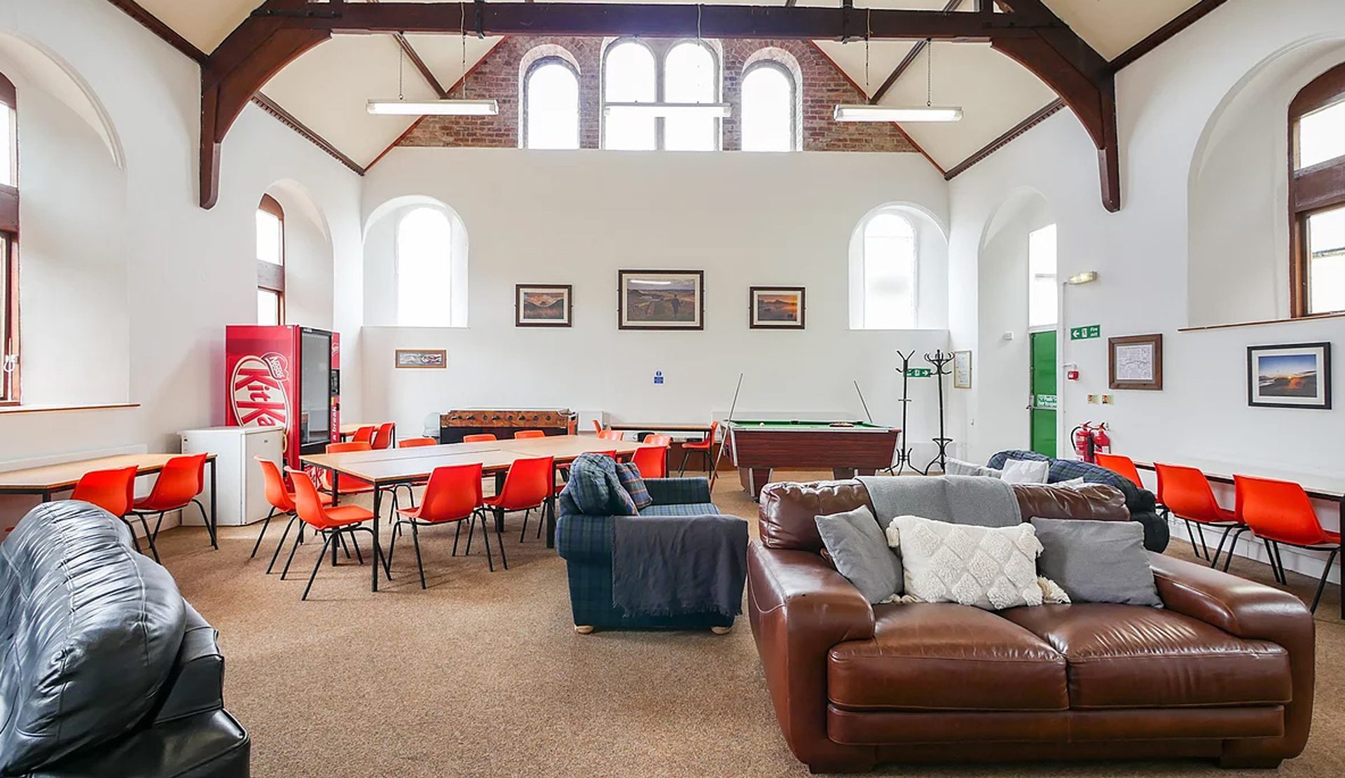
Why do hostels and bunkhouses have perfect facilities for large groups?
All the independent hostels and bunkhouses on this page are accommodations ideally suited for large groups. Sleeping 50 or more people, they have all the facilities a large group would need:
Large, fully equipped self-catering kitchens
Plenty of communal dining
Recreational spaces,
Equipment storage
Drying/laundry rooms
Large outside areas
Parking
Organised activities
Conference facilities and lecture rooms
And so much more.
Many of these large hostels and bunkhouses offer catering options to suit your large group’s needs such as providing meals or packed lunches. Many also have a variety of organised outdoor activities on-site or very close by which makes keeping your group entertained and having a memorable trip easier than ever.
Activities
Organised activities for large groups
Perhaps you want some organised outdoor activity for your large group? From relaxed walks to team building and high adrenaline activities, all is possible. Here are some of the activities we have available:
Guided walks
Caving
Climbing
Shooting
Quad Biking
Sailing
Coasteering
Kayaking
Many of the hostels and bunkhouses listed on this page provide a wide range of outdoor activities either on-site or close by. The necessary equipment can be hired, qualified instructors provided, and the health and safety requirements fulfilled. Get in touch with the hostel or bunkhouse to find out more.
Many of the large groups that use independent hostels and bunkhouses organise their own entertainment. The hostels and bunkhouses are quite happy with that. Large groups of kindred spirits meet up for a couple of days or longer to spend time together sharing their passion, be it bird watching, music, art, crafts, yoga, walking, cycling etc. The possibilities are endless.
Explore the countryside and find your own amazing places
Types of large group
All different sorts of large groups stay in hostels and bunkhouses.
You would be surprised at the wide variety of large groups of people who join together to spend days together in independent hostels and bunkhouses. Here are just some examples of the large groups who regularly come.
Or perhaps you want your big party of people to go somewhere peaceful, where distractions are minimised. In which case why not turn to the rugged beauty of the Highlands of Scotland, or the wilds of the Welsh mountains? Don’t forget our wonderful and varied National Parks. The Peak District, the Lake District, Yorkshire Dales & The North York Moors with their beautiful scenery and attractions all have large hostels and bunkhouses which can fit your big group. Then of course in Wales, you have the option of hosting your large group in the breathtaking splendour of Snowdonia or the Brecon Beacons.
Your large group may be happiest by the sea, watching the wildlife and walking along the shoreline. There are hostels and bunkhouses big enough for large groups on the idyllic coast of Devon and Cornwall. You will find others on or close to the dramatic Welsh coast in Pembrokeshire, Aberystwyth and Anglesey. Perhaps you would prefer to take your big party of family, colleagues or friends to the rugged & inspirational Scottish coast or the forgotten hidden beaches and dramatic skies on the Northumberland coast.
Ocean Backpackers, on the harbour at Ilfracombe
City Hostels
If you want your large group to be able to hit the nightlife, take in the culture or visit tourist attractions then a large city centre hostel is going to fit the bill. City centre hostels and bunkhouses are also popular when many people in your large party need to be able to travel there easily by public transport. Edinburgh, Glasgow, Newcastle, Manchester, Liverpool, York, Birmingham, Bristol, Bath, Canterbury and of course London all have independent hostels or bunkhouses that can accommodate big groups.
If you are feeling more adventurous you could always organise for your large group to go to Jersey, the Isle of Man or the Isle of Skye. It would make it all the more memorable for being just that little bit out of the ordinary. Whatever part of our beautiful country suits your large group best, you are sure to find a large independent hostel or bunkhouse nearby that can accommodate 50 or more of your guests.
Price
The cheapest form of accommodation for large groups
Hotels or party houses large enough to accommodate your large group will generally work out much more expensive than hostels or bunkhouses. This is because the number of people sharing each bedroom in the hostel or bunkhouse will generally be higher. The large self-catering kitchens mean that you can prepare all your own meals, thus keeping your costs down even further.
Flexibility
Hostel and Bunkhouse accommodation is wonderfully flexible
The beauty of hostel and bunkhouse accommodations for large groups is the option to completely tailor the holiday to your needs. You can stay for as long or as short a period as you like, weekends or midweek. You can self-cater or have a catered package. There is often a choice of room sizes/beds per room. You can opt for organised activities or organise your own. You can book the whole place for yourself or share the facilities with others. Please remember each hostel is unique, so do discuss your requirements with the manager.
To find out more use our Group Enquiry Service.
Using our Group Enquiry System you can choose a preferred area, group size, dates and facilities and outline your group’s requirements. Your enquiry will be sent to all hostels and bunkhouses that can accommodate your large group. They will then contact you directly to discuss your requirements. Why not give it a try and see how easy it is?
Each hostel and bunkhouse are unique. Have a look at each hostel’s details and follow the links to their website for much more in-depth information.
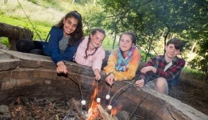
There’s no place like by the campfire or firepit. Whether with friends or soon-to-be friends, there are few better places to swap stories and reflect on the day than sitting around the fire pit or the campfire. Gathering firewood is a great activity, children love it. Even better there’s the satisfaction of cooking some sausages or toasting marshmallows on the fire you have just made. School and scout or brownie groups often make good use of the very same firepits. Using the opportunity of the hostels’ campfire for bushcraft lessons, learning how to start fires and safely put them out. Campfires are the perfect way to extend a fun-filled day, providing focus and warmth as the evening turn to night.
Toasting marshmallows is a great activity when sitting around campfires.
Why stay at a hostel with campfires?
Campfires are a great way of bringing people together. Even if you are total strangers a night around the fire will make you feel like you’ve been friends forever. They provide a focal point for people to gather and be hypnotized by their dancing flames no matter if you are young or old, fires fascinate us all.
Small Hostels are perfect for those wanting to travel as a small group or a family wanting somewhere affordable to stay. Whilst some of them are group only most offer accommodation to individuals prepared to share facilities with others. All of these hostels sleep 10 or less with some as few as 4 people in total. There are small hostels in the Independent Hostel Guide across the country, in England, Scotland and Wales.
But what makes a small hostel different from a holiday cottage? Well, most are available to individuals including Dacres Stable Camping Barn, Shepherds Crook Bunkhouse and Bunkorama so whilst there may not be many of you, you can still have the full hostel experience of meeting new people in communal areas.
All our small hostels have well-equipped kitchens, comfortable bunk beds, and hot showers and some have wood-burning stoves. Maentwrog Bunkhouse & The Wild Wool Barn are newly renovated farm buildings sleeping 4 and 6 respectively in bunk rooms. Maentwrog and Middle Ninfa Bunkhouse are located on a working farm.
These hostels may not sleep many but they are far from small when it comes to space both inside and out – with many having outside BBQ or firepit areas. As often quirky, always stunning, locations to stay where not so many people have trod the path before you they are second to none.
Small hostels are great for having the full hostel experience on a smaller scale!
We have a wide range of accommodation that specialises in providing low cost accommodation for youth groups. From activity centres to scout hostels, we have venues across the UK that are ideal for your youth group.
Woodcraft Folk Hostel at Lockerbrook Farm Outdoor Centre
Often in amazing wild locations and always with exclusive use of the whole place, your youth group will have access to all the space they need for indoor and outdoor adventures.
Subsidised low prices and flexible food and activity options mean that you can choose an adventure to suit your budget, no matter how small it is.
All the accommodation has self-catering kitchens, and in some you can opt for a fully catered options with breakfast, packed lunches and evening meals. Or just buy in the meals you require from locally recommended external caterers.
Many places also offer outdoor activities, but you can also choose a totally self-led stay. Make an outdoor adventure by exploring the local walks and beauty spots, and an indoor adventure with warm home cooked meals, story-telling, quizzes and board games.
Subsidised stays guarantee that your residential is tailored to suit the needs and budget of your group.
You are spoilt for choice with some amazing places to stay during your hike, from idyllic, secluded, and rural bunkrooms to bustling, self-catering hostels. There is a place to rest your head at every step of the journey. Not to mention the communal rooms to relax in and meet other travellers in and the self-catering kitchens.
We know the importance of conserving your energy for when it matters most. This is why all the hostels and bunkhouses on this map are very close to the wall itself. This means no extra walking when all you want to do is have a hearty meal and a lie-down!
Relax in Slack House Farm‘s kitchen and plan the next step of your route.
Our hostels are no strangers to Hadrian’s Wall walkers, this is why many of them provide evening meals and/or breakfasts, are dog friendly and provide bedding.
The Pennine Way: An interesting and varied route over 268 miles of stunning upland countryside…..just waiting for you to walk it!
The Independent hostels and bunkhouses listed above provide ideal accommodation along the Pennine Way. All with self-catering facilities, many provide meals and packed lunches on-site or in nearby cafes and pubs.
No longer the basic accommodation of former times, much of this accommodation offers walkers a level of comfort and service ideal after a long day’s walk. They are warm, cosy, comfortable and well-appointed with a choice of private or bunk rooms often with an en-suite option. Bed linen and towels are provided.
Designed with walkers in mind, you’ll find drying rooms, storage for muddy boots and friendly communal areas where you can relax and share tales of your day’s adventures in front of a roaring fire. Some places have their own bar so you can enjoy your favourite tipple as you rest your aching bones! As well as your overnight accommodation, some accommodation provides a pick-up or drop-off service and a luggage transfer service.
Do check with each place as to exactly what they are able to provide before you book.
You will find overnight accommodation all along the Pennine Way. All the independent hostel and bunkhouses on the Pennine Way is shown on the map at the top of this page. Enlarge it as you wish and click on the red flags for the link to the individual accommodation details. For full details of the progress of the route and other resources look on the LDWA website.
Beginning in the quiet village of Edale, the Pennine Way crosses the moorlands of the Kinder Plateau, meanders up into Bronte country and the limestone of the Yorkshire Dales National Park where walkers travel via Malham, Pen-y-Ghent, Great Shunner Fell and Keld.
You have a choice of bunkhouse and hostel accommodation in or around Edale at the start of the Pennine Way.
There is:
Edale Barn Cotefield Farm (<1KM from The Pennine Way path)
Ollerbrook Farm Bunkhouses (<1KM from The Pennine Way path). Two bunkhouses welcome groups and individual walkers, a short walk from the start of the path.
John Hunt Base (4KM from The Pennine Way path)
Hagg Farm Outdoor Centre (4KM from The Pennine Way path)
Pindale Farm Outdoor Centre (4KM from the Pennine Way Path)
The Pennine Way in West Yorkshire and the Yorkshire Dales
One of our hostels, the Hebden Bridge Hostel has been involved in creating the new and much improved ‘Hebden Bridge Loop on the Pennine Way.
Hebden Bridge hosts Em and Dave are keen walkers and helped instigate the new path which was launched in 2015 to celebrate the 50th Anniversary of the Pennine Way. The new Loop follows footpaths to the heart of the picturesque market town of Hebden Bridge (instead of the ‘A’ road necessitated by the original route) and also takes in the historical village of Heptonstall en route.
.
Hebden Bridge Loop on the Pennine Way
Other independent hostels and bunkhouses offering accommodation along The Pennine Way include:
Earby Friends of Nature House (2KM from The Pennine Way path)
Airton Barn, Friends Meeting House (<1KM from The Pennine Way path). After Airton Barn between Silverdale Road and High Birkwith, the Pennine way climbs Pen-y-Ghent. At 2227ft it is the smallest of Yorkshire’s three peaks.
Height Gate (1KM from The Pennine Way path)
3 Peaks Bunkbarn (1KM from The Pennine Way path)
Chapel Gallery Bunkhouse (<1KM from the path)
The Pennine Way at Pen-y-Ghent.
Pennine Way where it crosses the Dales Way
The path descends to the River Tees and follows the river up past High Force and Cauldron Snout waterfalls before rising up and crossing the fells to High Cup, Great Dunfell and Cross Fell. This climb is followed by another descent into Alston, which shares the title of England’s highest market town with Buxton, close to Edale at the southern end of the Way.
The Pennine Way in the North Pennines, the “Roof Of England”
Hostel and bunkhouse accommodation along the Pennine Way in the North Pennines includes:
Haggs Bank Bunkhouse & Camping (4KM from The Pennine Way path)
Garrigill Village Hall (<1KM from the path)
Alston Youth Hostel (<1KM from the path). The most directly situated hostel on The Pennine Way in this area.
Slack House Farm (3KM from The Pennine Way path)
Greenhead Hostel (<1KM from the path)
Gibbs Hill Bunkhouse (2KM from The Pennine Way path)
Winshields Bunkbarn & Campsite (<2KM from the Pennine Way path)
Alston Yha (also Independent) directly situated on the Pennine WayGibbs Hill Bunkhouse on the Pennine Way
After entering the Northumberland National Park the Pennine Way path follows Hadrian’s Wall to Housesteads Fort before veering north again. The last section takes in the Kielder Forest, Redesdale and the uplands of the stunning and isolated Cheviot Hills. Here the path runs along the border with Scotland before crossing it and gradually heading down to Kirk Yetholm. There are a number of loops that can be taken off the main trail and it also links to the Coast to Coast and St Cuthbert’s Way.
The Cheviot Hills
Pennine Way in the Scottish Borders and Northumberland
Hostel and bunkhouse accommodation along the Pennine Way in the North Pennines includes:
Tarset Tor Bunkhouse and Bothies (<1KM from the path)
Mounthooly Bunkhouse (1KM from the path)
Kirk Yetholm Friends of Nature House is situated directly on the path at the end/start of The Pennine Way. The classic stopover!
Kirk Yetholm Youth Hostel
This article shows the location and details of the hostels and bunkhouses along the trail. Full details of the route and other resources can be found on the LDWA website.